Eastside Stories

Chicken Farms on the Eastside

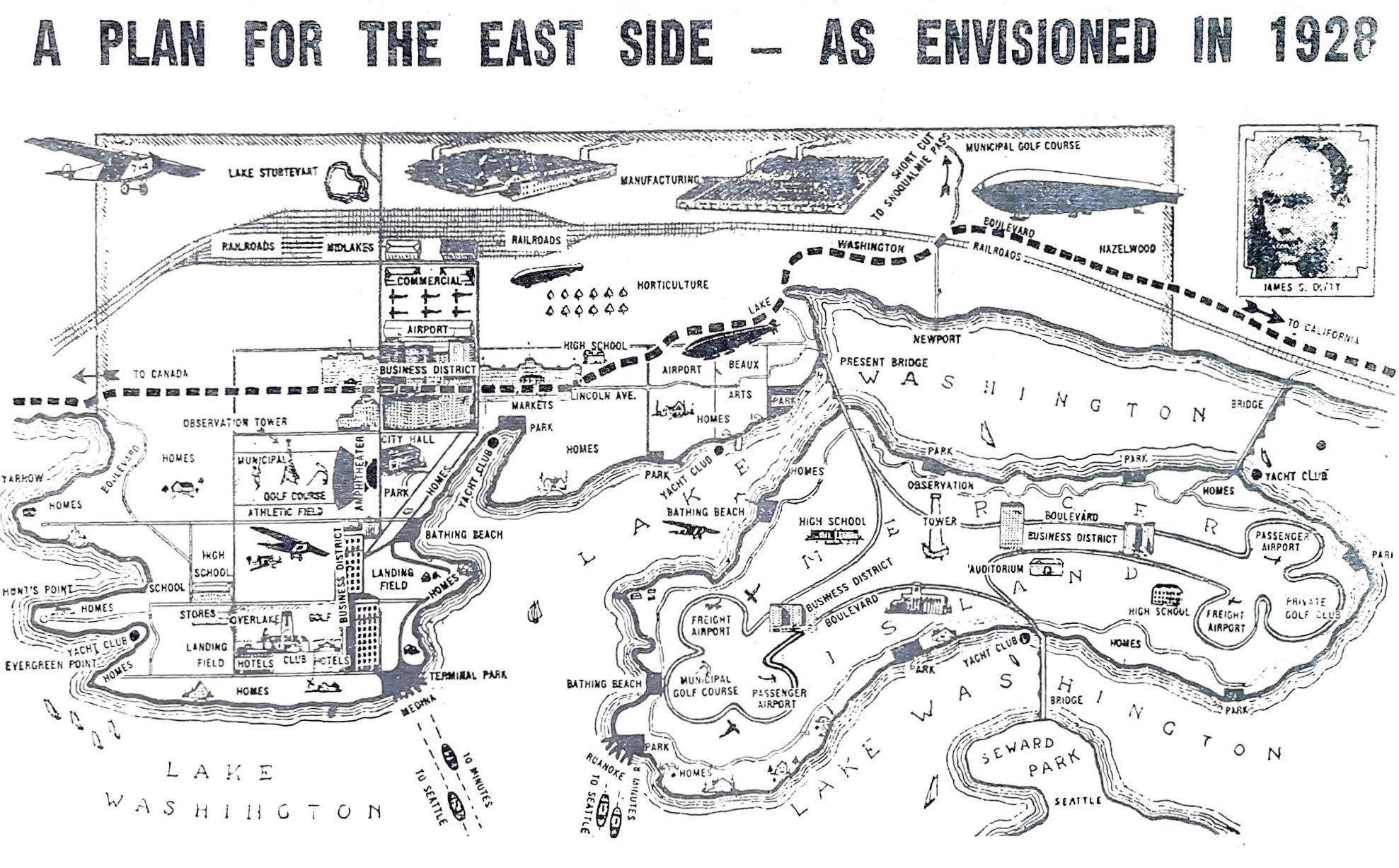
By Barb Williams, Eastside Heritage Center volunteer

Pioneer families often raised chickens. The birds were inexpensive to feed, produced eggs for baked goods, meat for the table and a source of feather-down for pillows and quilts. Many of the Eastside pioneers raised chickens for their individual needs.

Dwight Skinner was one of several Eastside residents who raised chickens commercially. In 1912, Dwight and Nell Skinner bought a 40-acre tract of land on the Highland-Larsen Lake Road. The land had belonged to the Churchills and included a home, barn, feed room and two-story chicken house. Dwight suffered from heart problems and was often unable to work. He had 2,000 to 5,000 chickens whose eggs, he figured, would help to supply the income he needed.

L 86.024.004 - Mr. Harmon feeding chickens at Morelli chicken ranch, 1918

The Morelli brothers; Alfonso, Martin, Silvio and Tito immigrated from Italy and bought land along 148th Avenue in Redmond. They ran a thriving chicken ranch from 1915 to 1973. It was the biggest of its kind on the Eastside at the time. They had 15,000 chickens who had the run of long elevated chicken houses. The business became such a success that they operated through a middle-man and never had to advertise. In the 1940s, they pioneered in the use of electricity by installing timed electrical lights in the henhouses. The timers turned on the lights at 4 a.m. extending daylight hours, egg-laying time and egg production. In the 1970s, some of the Morelli land across 148th was developed into private homes. Silvio passed away in 1979 and Microsoft bought the land in the 1990s with the stipulation that Silvio’s wife, Albarosa, could remain in the family home as long as she wanted. She passed away in 1999 and Microsoft proposed turning her home into a library.  

For nearly 40 years around 1922, 116th Avenue NE between Main Street and NE 8th in Bellevue was known as Lebanese Valley because most of the residents were from Lebanon. George Waham was a resident. He bought five acres and started a farm on which he raised chickens, a cow, rabbits, fruits and vegetables. During the Depression he and his wife fed other people including their large family.

OR/L 79.79.342 - Chicken in front of farm building, Willowmoor.

In 1927 two black men, A. Cunningham and C. James, came from Seattle to become the proprietors of the Wake Robin Lodge located in Enatai. Their business was the first on the Eastside to be operated by black people. The Lodge became famous for the fresh food raised on-site, especially its chicken dinners. Fruit trees and a large garden supplied produce. Long chicken coops stretched along the south side of the property with a small dairy nearby. Mr. Jones tended the chicken ranch which consisted of a  number of chicken houses. He raised white leghorns. He lived with his wife onsite in a home under the water tank. The water, used for the chickens and lodge, was pumped uphill from a well on Lake Washington Boulevard. Due to the Depression, the Lodge closed in 1934. 

Presently chickens can be found at Kelsey Creek Farm Park owned and managed by the City of Bellevue. Breeds of chickens are selected for their personalities, egg color, feather color and characteristics appropriate for public viewing. Wyandotte, Barred Rock, Ameraucana and Bantam are some of the breeds selected. The purpose of the farm is to educate people about animal husbandry. Chickens often feature in events and classes taught by farm staff. Some chickens are good egg-layers, others better for meat and some are dual-purpose. Historically they have connected with humans for a long time.

Sources:

Eastside Heritage Center archives

Carla Trsek, Kelsey Creek Farm Park staff

Culinary History of a Pacific Northwest Town by Suzanne Knauss.  2007

The Lake Washington Scenic Highway

BY margaret Laliberte, EASTSIDE HERITAGE CENTER VOLUNTEER

W.E. LeHuquet, owner and editor of Bellevue’s Reflector newspaper liked to call it the Lake Washington Scenic Highway. The Seattle Star newspaper preferred Lake Washington Boulevard.  Both were referring to the string of streets and highways eventually stitched together to form a continuous 52-mile route circling Lake Washington. In an opinion in 1919 urging readers to support the completion of a final four-mile segment between Bellevue and Newport, the Star exclaimed “Do you realize that this boulevard, when completed, will give to Seattle the most beautiful circuitous trip in the state and that it will be one of the principal scenic attractions of King county”?

L 84.028.1 - Ditty City 1928 illustrated map of Bellevue - John Ditty's vision of the future.

The final stretch was indeed completed, and on June 5, 1920 an autocade traveled from Seattle’s County-City Building around the north end of the lake to Bellevue’s Wildwood Park near Meydenbauer Bay for festivities showcasing speeches by officials of the Automobile Club of Western Washington as well as past and current county commissioners. The Bellevue District Development Club had decorated the town with flags and banners, and Eastside ladies’ committees served coffee, lemonade and sandwiches. The event was hosted by the Reflector.

During the 1920s and 30s, the Seattle Star sponsored an annual 52-mile walking contest around the lake. Contestants who decided that by the time they reached Bellevue they’d  had enough were offered transportation across the lake back to the City.  In 1928 the male winner of the race finished the entire course in 9 hours, 24 minutes.  His first-place cash prize of $250 would be worth about $4,000 today. The winning woman, a Monroe teacher, finished in 13 hours, 11 minutes. (The Seattle Times announcement did not mention whether she too received a prize.)

It is not likely that the all the roads constituting the entire route were ever known uniformly as  Lake Washington Boulevard.  In Seattle the Olmsted firm laid out the section running from Montlake to Seward Park along the lake shore; it is still Lake Washington Blvd.  On the Eastside in 1945 a long stretch of road called Lake Washington Boulevard ran north from Renton along the lake shore to Factoria.  It turned west along S.E. 32nd (which no longer exists there) and then angled diagonally across Mercer Slough to where the Winters House stands today.  It followed 104th Ave. NE to today’s Main Street, where it ran west along the lake to 84th Ave. NE.  At NE 28th it turned east to run along the south of Hunts Point and Yarrow Point on what is today called Points Drive to an intersection at Northup Way.  Continuing north towards Hougton it was called Lake Washington Blvd until it reached the Bellevue-Kirkland boundary.

From today’s perspective, one wonders why the route didn’t simply run due north along present Bellevue Way/104th Ave. N.E. Early developer James Ditty thought the same thing.  According to local history writer Lucile McDonald, when what later became Bellevue Way was just a “cow trail” called Peach Street in the late 1920s, Ditty bought 38 acres around today’s intersection of Bellevue Way and N.E. 8th St.  He granted King County an easement across his property, and in 1930 the newly paved road running north toward Kirkland was renamed Lincoln Avenue.

Remnant stretch of Lake Washington Boulevard

Ditty’s property became the new nucleus of Bellevue’s commercial district. But Lake Washington Boulevard continued to meander closer to the lake shore. An almost overgrown remnant of the old paved road can still be walked between Bellevue Way and N.E. 35th Place in Clyde Hill, just south of the sound wall of SR 520. In summer prolific brambles offer up ripe blackberries for the picking.

References

Reflector editions (is this kind of resource just called EHC archives?)

Seattle Times May 20, 1928

Seattle Star, July 26, 1919 (graphic of LWB route)

Lucile McDonald, Bellevue, Its First 100 Years

Kroll Eastside map book 1945

HistoryLink Essay #10244, “Lake Washington Boulevard”

Holly Farms in Bellevue

BY Barb williams, EASTSIDE HERITAGE CENTER VOLUNTEER

Who would think that Bellevue in the 1920s had the most extensive holly farm in the United States? But it did thanks to the patience and vision of Edward P. Tremper and Dr. C. A. Holmes. Patience because it takes 15 to 18 years before a crop becomes commercially productive. Tremper ran an insurance business and Dr. Holmes was a dentist. They were neighbors in Seattle. In 1900, Tremper bought 10 acres of land on Yarrow Point and moved there two summers later. He had the unprecedented idea of planting a holly orchard which he did in 1902. He ordered 1,000 young plants from France, planted them and waited for them to mature. His holly farm was the first on Puget Sound.

Ilex aquifolium

Dr. Holmes liked the idea and bought 10 acres at 111th Avenue SE on the east side of Enatai. After he died in 1933, Tremper acquired the land thus making the Tremper family holly plantation the biggest in Washington State, according to the 1929 issue of Nature Magazine. By 1930, the Tremper family planted five additional acres on the east side of 92nd using a variegated type of holly. The farm continued to expand and grow boasting 3,000 trees by the 1940s. At this time Tremper’s three sons were running the business. During the busy winter holiday months, they hired many packers and cutters, the majority of whom were Japanese farmers. The Trempers also bought holly from a farm on Mercer Island and shipped gift boxes all over the country.

As Tremper continued his experiment, he discovered that he only needed a few male(bull) trees and therefore planted mostly female trees. Both sexes were needed for pollination, but it was the females that produced the desirable red berries used for decorations, especially at Christmas time. However when many of the Japanese were forced to leave the area during World War II, it became difficult to find workers. Added to this, weather conditions produced overtime hours which resulted in additional wages. Property taxes increased and by 1946 the Trempers quit operating the Enatai property. They closed the original farm at Yarrow Point in 1956.

Ilex aquifolium

Holly trees can still be found in Bellevue. The evergreen plant continues to be a favorite for winter holiday designs and decorations. Although the berries are toxic to humans and most household pets, they are a winter food resource for birds such as robins. As a shrub-like tree, it can grow in height from foot-high dwarfs to fifty-foot tall trees. Due to its prickly evergreen leaves, it provides a safe, warm place for nesting birds in winter when deciduous trees lack leaves. In England, the holly is often used in hedgerows to contain farm animals or to separate one area from another. The prickly tough leaves provide a formidable barrier.

The holly is one of the most respected and loved trees in Celtic lore. A holly wreath was worn as a crown by Celtic chieftains for good luck. Traditionally, newborn babies were protected from harm by bathing them in water from the leaves. The tree represents peace and goodwill. Due to its resistance to lightening, it was planted near houses to protect people from lightening strikes. The Druids also believed in it’s protective powers. Their legends tell how the leaves, if brought into the house during the winter months, would provide shelter and warmth for fairies who would then be kind to those who lived in the home.


Resources:

Eastside Heritage Center archives

Lucile McDonald Journal American article 4/6/1977 “Holly sprouts left from pioneer farm”

Online:  Holly Tree Meaning,  The Symbolic Significance of Holly,  “Bellevue’s history is rooted in rich farmland” article by Sherry Grindeland

Sunset Western Garden Book,  1995.

The Early Community at Northup

BY margaret Laliberte, EASTSIDE HERITAGE CENTER VOLUNTEER

Drivers negotiating the SR520/I-405 interchange can be forgiven for not realizing that they are passing right over the site of the little district of Northup, which developed in 1890s. Virtually all of it has been erased from today’s landscape.

In 1884 or ’85 James Northup recorded his land claim at the head of what is now called Yarrow Bay.  He and his wife Almira built a cabin on property.  They were joined by their son Benson, who in 1889 built a larger house very close to where today’s Burgermaster Drive-In restaurant stands. At some point the Northup Dairy and Cherry Farm existed on the property.

Florella and Benson Northup, 1912. (L85.2)

When the Northups arrived,  King County’s population was exploding: it grew from 6,910 in 1880 to 63,989 in 1890, an increase of 826%!. Just to the north, beginning in 1888, Peter Kirk and Leigh S.J. Hunt planned to industrialize the area with a huge iron and steel mill , a project that soon collapsed. But Northup’s neighborhood was still deep woods and scattered families.  There was never a town, really, more a collection of essential community services that sprang up over the early years. The dock on the bay became known as Northup Landing.   A Methodist Episcopal church was founded in 1888.  A post office opened in July 1892 and lasted until 1897. Local resident Mrs. Ann Dunn was postmaster.  Apparently at some point there was also a store.

Perhaps as early as 1879 a group of local settlers had filed a petition with the King County Commissioners of Washington Territory for a public road to run east and intersect with the only north-south road then existing that connected the area with the mines at Newcastle (now 140th Ave. N.E.).  At first the road apparently ran due east from the bay.  In 1886 its route was altered to run southeast so as to avoid the steep section over “Fagerburg Hill.” Originally called Road 85, it became known as Northup Way.

Northup got its school around 1890, located on what is today’s 116th Ave. N.E. north of Northup Way. In the 1960s an early resident, Hattie Goff Norman, recalled that “it was a very fine building with a belfry and large bell, cloak room, and ink wells in the desks.”  The first teacher, Margaret Yarno, commuted across the lake to Northup Landing from Seattle. In 1893 the school reportedly had 24 boys and 26 girls, although only about 16 children usually attended. In the early years teachers and their pupils put on evening programs—short plays, tableaux, recitations—for parents and the community.

Pupils of the Northup School with their teacher, Margaret Yarno, probably ca. 1893. (L82.050.025)

At one point the hills above Northup were being logged. A wooden chute, greased with axel grease, was built to shoot the logs downhill to the lake, and a gap was left at the point where the wagon road crossed it. A guard was stationed at the gap to insure that passersby wouldn’t be hit by a log hurtling down the chute, jumping the road, and diving into the water.

In 1905 the railroad finally came through Northup when the Northern Pacific finally completed its line between the Black River (southwest of Renton) and Woodinville.  One of two “stations” in the Bellevue area—the other was Wilburton—Northup had a depot in an old boxcar and a siding that could accommodate 50 railcars.  The line was primarily for freight and had originally been envisioned as a bypass around the congested railyards in Seattle. 

Perhaps the railroad’s printed schedule of September 1905 was partly responsible for the confusion that developed over the area’s name—was it Northrup or Northup? The schedule listed the station as Northrup.  In the 1930s road engineers furthered the error by installing road signs on “Northrup Road.”  Only in 1970 was the great-great-granddaughter of James Northup able to convince the Bellevue City Council of the correct family name, and the signs were finally rectified.

Heart of Northup in 1913, looking north up116th Avenue NE. Northup School with its belfry is visible on the upper right of the photo. Note the Northern Pacific’s boxcar “station” just beyond the railroad tracks. Courtesy Matt McCauley.

Today Northup is very much a lost landscape.  Benson Northup’s home still stood in 2007 when a cultural resources assessment was compiled in connection with the expansion of the South Kirkland Park & Ride. But today commercial and residential buildings occupy the site. Further to the east, the Northup School building became a private home in 1940, was  eventually purchased by The Little School, and was demolished in 2019.  But the rail corridor—without its tracks—survives as a section of Eastrail, which will eventually link Snohomish with Renton in a continuous biking and walking trail.  And Northup Way survives as well, continuing to wind around the hill to link the Houghton and Overlake districts.

Resources:

Seattle Daily Times, Sept. 23, 1905, p. 6

Kirklandhistory.org/1905-lwbl-ckc/1905-lwbl-history

Felix Bunel, MyNorthwest.com/157612, Nov. 1, 2019

Lucile McDonald, Bellevue: Its First 100 Years and an undated Journal American article

Vertical File, several photocopies of petitions pertaining to Road 85 (Northup Way)

John Caldbbrick, HistoryLink Essay 9621 re 1890 federal census

AMEC Earth and Environment Inc. “Cultural Resources Assessment of the South Kirkland Park & Ride Transit Oriented Development” Sept. 4, 2007

Hans Miller and Albert Burrows Cabins

The Hans Miller and Albert Burrows cabins will be the final article on “Bellevue’s Early Cabins”.  They are located in Bellevue Parks, but not open to the public.  Hopefully, at some future time, Eastside Heritage Center will be able to do outdoor programs at these sites.

Burrows Cabin, Rody Burrows on porch. (OR/L 79.79.533)

The Burrows cabin is the oldest of the five featured structures.  In 1882, Albert Burrows filed a land claim on the east side of Lake Washington and built a 14 x24 cedar log cabin, chinked with clay and moss. Albert was a Civil War veteran from Iowa and this land was part of the Homestead Act. The area became known as Burrows Landing, just south of Chism Park.

In the 30s, the cabin was moved to Bellevue Way, near Bellevue Square, and later, in 1946, to a site on 112th Ave. NE.  It remained a private residence until 2016 when it was transported to Chism Park. It is thought to be located near its original site and can be seen on the upper lawn of the park.

Miller Cabin at Robinswood Park, 1976. (L88.064.006)

The Hans Miller Cabin is found at Robinswood Park, its original location.  The cabin was built in 1884 by a settler from Denmark, Hans Miller, and built quickly for immediate shelter.  He also built a log barn a few years later.  Both structures were built with axes and cedar trees.

In 1978, the city of Bellevue dismantled the cabin, and reassembled it on its original site.  Most of the logs for the four walls are the original ones that Miller chopped down in the 1880s.  The new shakes on the roof were hand-split like the originals.  A floor was installed and unbreakable glass to help with the vandalism.  Ed Kelly, Jerry Garrison, and Jim Fifer were responsible for the restoration work.  It is still hoped that the cabin can be used at some future date.


Resources

Eastside Heritage Center Archives