
Eastside Stories is our way of sharing Eastside history through the many events, people places and interesting bits of information that we collect at the Eastside Heritage Center. We hope you enjoy these stories and share them with friends and family.
Eastside Stories
The Eastside Heritage Center has a large collection of quilts which date from the mid-1800s to modern day. Patchwork quilting is an American tradition used mainly by women to create useful blankets, preserve family trees and memories, and demonstrate a wide range of skills related the textile arts. A quilt is made by joining a patchwork top layer to a solid or also patched backing, although they are warmer with a cotton sheet or batting layer in the middle this is not always a part of the quilters creation as it can be expensive or hard to find at certain periods of the past.

Photo above: Detail of quilt made of hexagon patches shoeing hand stitching.
Quilting is a very time-consuming task and one can imagine how much more so before sewing machines were readily available. The smaller the patches the longer the quilt would take to make with the hexagon flower pattern above. Each hexagon is only about an 1 ½ inch tall and the top layer for this is completely handsewn. It’s no wonder the quilter didn’t finish stretching and sewing this quilt to the backing. Still, this quilter’s labor is preserved in the EHC collection.
Some quilt designs are the result of fads like the Victorian era crazy quilt while many quilts are made from necessity. Quilters will often utilize any material they can find from fine ribbons and lace to worn clothes and flour sacks. Historically some companies have even catered to this by printing designs on their sacks or providing small slips of silk in cigar boxes which could then be used to make quilts. In the Eastside Heritage Center’s Collection there are quilts which still bare the logos of the mills which produced the flour backing some of the quilts.

Photo (above): Red, white, and blue patchwork quilt using the pattern known as "Job's Troubles".
Many quilt patterns were developed from stories in the Bible such as the quilt above showing a pattern called “Job’s Troubles”. The character Job in the Bible faced many hardships but kept his faith in God and may have been an inspiration for women who traveled west and faced many hardships themselves as they made a new life for their families. Often the creator of a pattern goes unknown. Just like today, quilters learn from each other and emulate what they see through skill. The four patches at each corner create a star and the four stars coming together create an almost circular shape. This quilter plays with the negative space by keeping all the larger patches white so together they emphasize the stars and the stars complement the shape back.
Quilts take so long to make that sometimes quilters start them and work on them for years or set their work aside and come back to it after a long period of time. There are two quilts in our collection which were started and finished about forty years apart. We know this because the quilters themselves documented the years they worked on each. In the back-left corner of a sunbonnet quilt, in a hard-to-read red thread over blue, white, and red flowers, are the words “Made by Georgia and Essa Smith 1938-1979”. Another quilt made by the sisters, featuring 25 stunningly hand-embroidered flower panels, reads “Made by Georgia & Essa Smith”/”Started 1930”/”Finished 1979”. Sometimes hand-stitched records like this are all we have to tell us who, what, when, and where regarding the quilts and other textiles in our collection.
Still, many things can be learned based simply on the patterns chosen, the cloth utilized, and the pictures, shapes, and stiches used to create each quilt. Quilts can be used to document communities, like one quilt in our collection showing the “5 Points Neighborhood” which existed on an intersection with five points that no longer exists. Their matching patches document the shape of the streets and show the creativity of each group who created them. Quilting can be an individual or a community activity and either way gives a unique glimpse into moments and times throughout east King County’s history. To see more patterns and learn about the history of quilts, download our new Basic Quilt Coloring Book and look out for more information on our quilt collection.
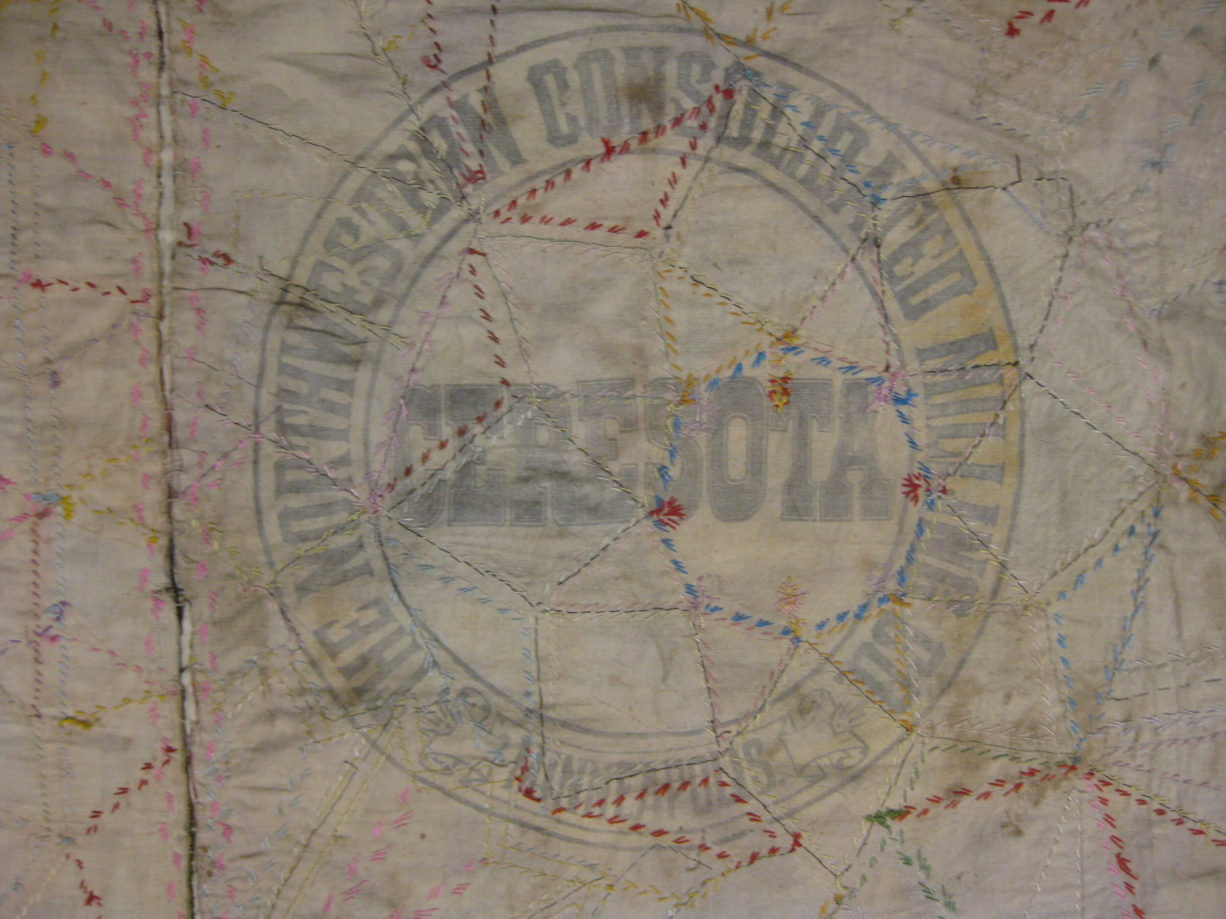
Photo (above): Quilt showing the use of printed bags from milling companies as backing for a crazy quilt.


